Guia Hill and Lighthouse
Guia Hill is the useful elevated half-day on the Macau Peninsula: a short cable-car option, a shaded ridge, a seventeenth-century fortress and chapel, and the 1865 lighthouse that anchors the city's maritime geography. The best route is north to south, so you do not climb to the same summit twice.
Begin at Flora Garden, use the cable car only if it is operating, walk roughly 0.7 km across the hill to Guia Fortress, then descend about 0.5 km toward Calcada da Guia. Allow two to three hours, or longer if you walk up instead of riding and spend time with the chapel frescoes and viewpoints.
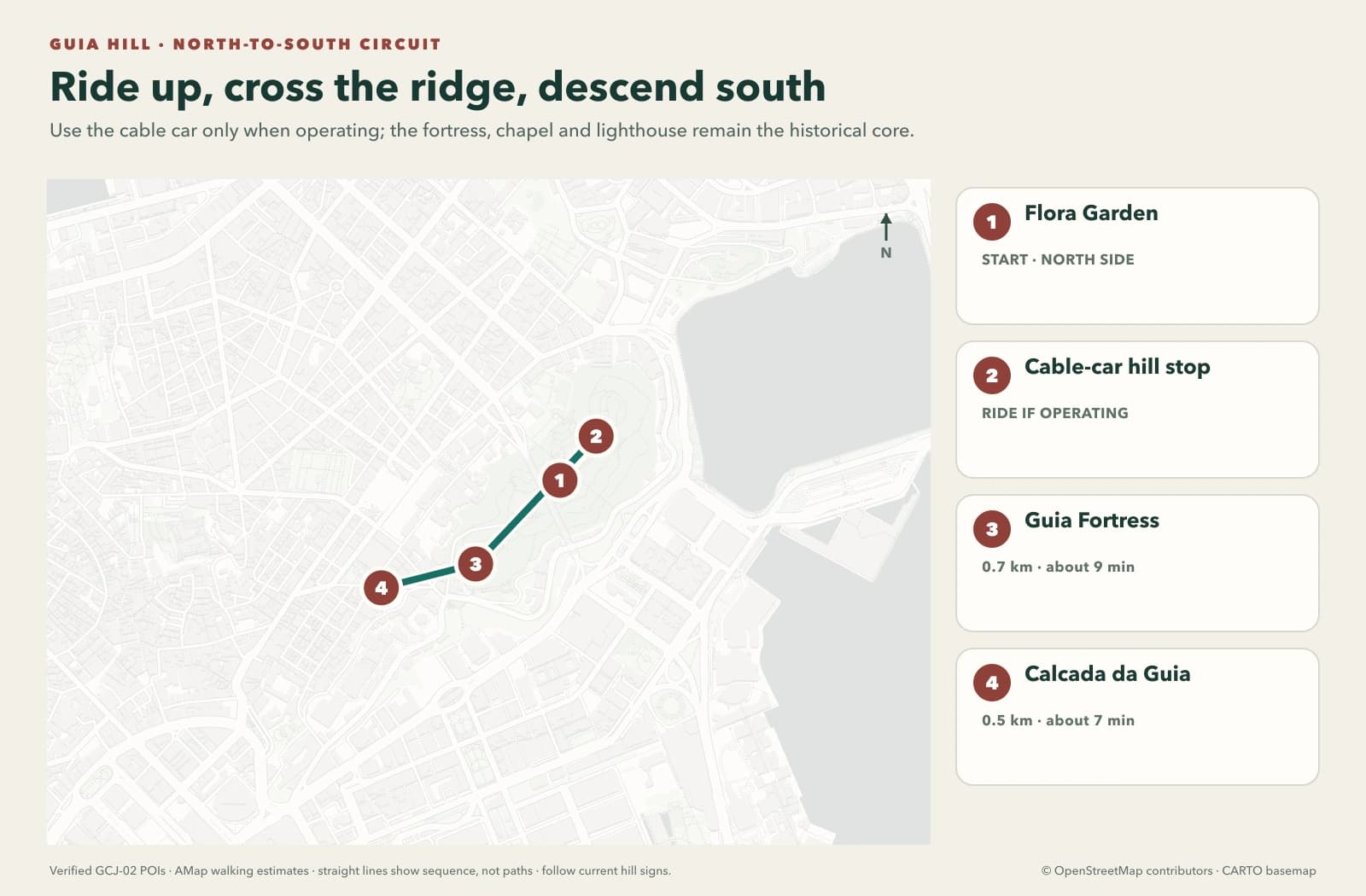
The dashed segment is an optional cable ride. Straight lines show sequence, not the exact trail; current hill signs, maintenance barriers and weather notices control the route.
1. Start at Flora Garden
Flora Garden provides the clearest northern approach. Use the garden as a short orientation stop rather than a separate attraction checklist. From here, choose between the cable car and the uphill paths according to operating status, heat and mobility.
The cable car's official listing currently publishes 08:00–18:00, normally closed Monday, with the closure shifted when Monday is a public holiday or compensatory rest day. The published fare is MOP 2 single / MOP 3 return. Those details are unusually affordable but still operational: maintenance, weather and holiday arrangements override. Check the official cable-car page before building the day around it.
2. Treat the Cable Car as Access, Not the Attraction
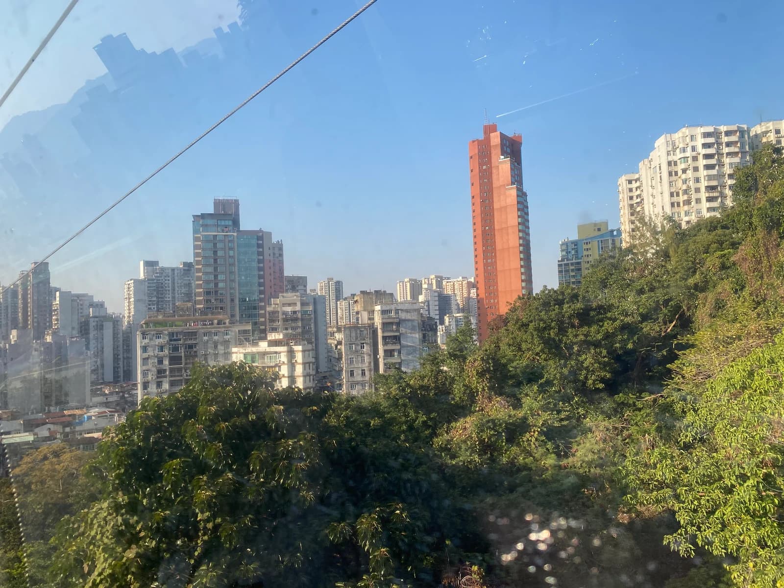
Documentary photograph by LN9267, adapted from Wikimedia Commons under CC BY-SA 4.0.
The ride is short and functional. Its value is reducing the initial climb and revealing how densely the peninsula meets the green hill. Do not wait through a long disruption merely to “complete” it; the walking approach or the Guia Hill pedestrian tunnel/lift system can be the better access method.
The tunnel and walking system improve north–south access, but moving walkways and lifts can close independently. Follow current signs instead of treating a static diagram as an accessibility guarantee.
3. Cross the Ridge to Guia Fortress
AMap's verified walking plan from the hill-stop map location to Guia Fortress is about 0.7 km / 9 minutes before photo stops, slope and route deviations. The health trail and ridge are the transition: look outward where vegetation permits, but do not step beyond barriers for a cleaner skyline frame.
The official heritage page lists the fortress as 09:00–18:00, with last admission at 17:30. Arrive early enough that the internal gate, chapel and exterior views are not compressed into the final minutes.
4. Fortress, Chapel and Lighthouse Are Three Different Things
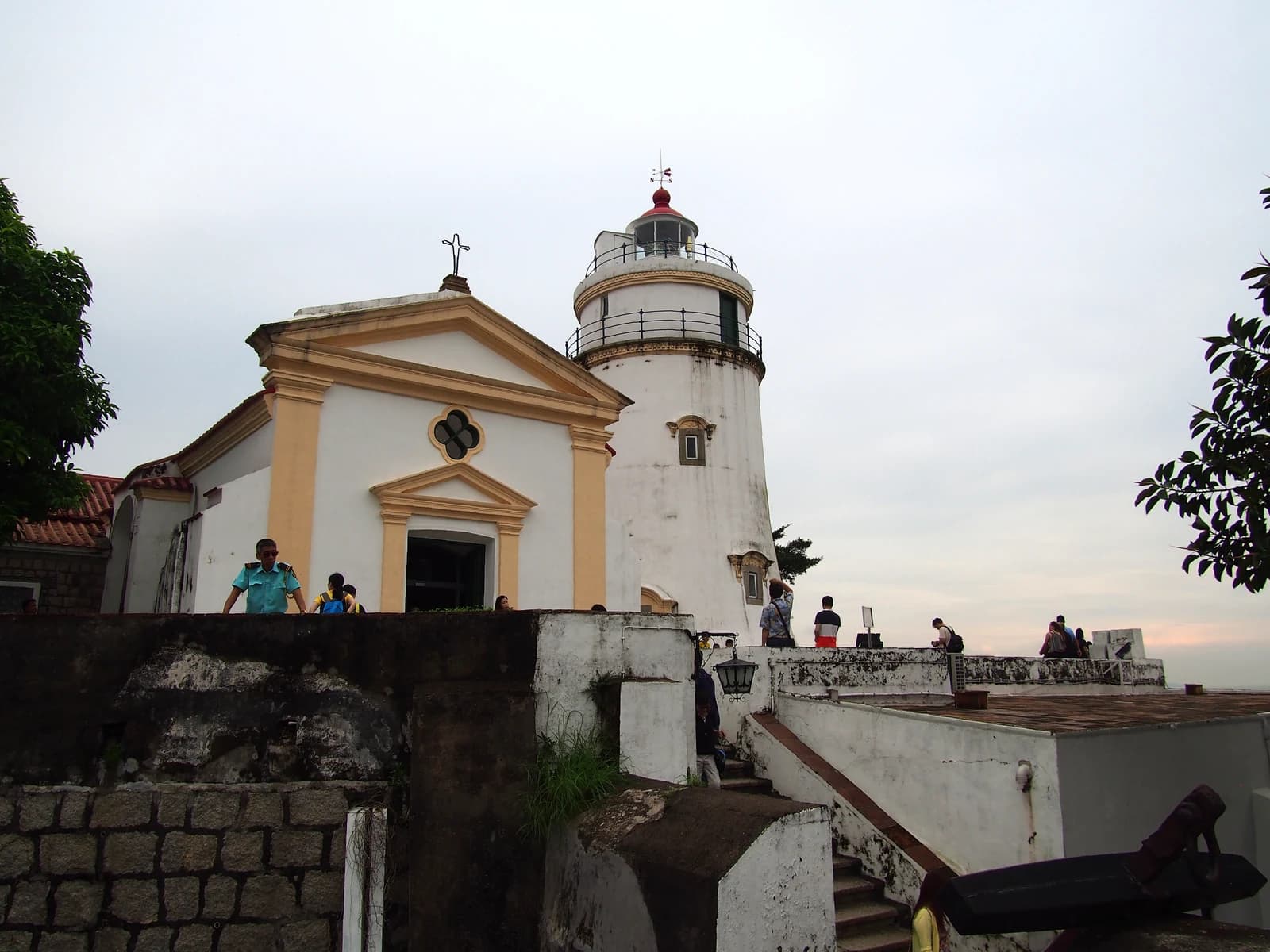
Documentary photograph by rheins, adapted from Wikimedia Commons under CC BY 3.0.
The fortress was built from 1622 to 1638. Inside it, Guia Chapel dates to around 1622, while the lighthouse dates to 1865. The official heritage authority identifies it as the first modern lighthouse on the Chinese coast and notes that Macau's geographic coordinates were historically taken from its location.
Access is not identical:
- Fortress: currently 09:00–18:00, last entry 17:30.
- Guia Chapel: currently 10:00–17:00.
- Lighthouse: not open to the public.
Photographing the lighthouse exterior is the visit. Do not describe the tower as a climb or promise an observation deck. Inside the chapel, the conserved murals combine western religious subjects with Chinese motifs and techniques; keep voices low, follow photography rules and allow worship or conservation work to take priority.
Verify the live schedule on the official Guia heritage page.
5. Descend Toward Calcada da Guia
The verified fortress-to-Calcada da Guia walking plan is about 0.5 km / 7 minutes, but the actual descent depends on the signed path and open gates. This southern exit creates a useful continuation toward the central peninsula without repeating the cable-car approach.
If knees or heat make descending uncomfortable, return by the gentler known route or cable car rather than forcing the circuit. A one-way line on the map is a planning preference, not a mobility rule.
Photography and Visibility
- Clear morning: better for layered peninsula views and lower heat.
- Late afternoon: warmer light, but do not trade away fortress or chapel opening time.
- Haze: focus on fortification walls, chapel-lighthouse geometry and vegetation rather than promising a panoramic skyline.
- Rain: stone and tiled surfaces can be slippery; skip the ridge in lightning or severe wind.
Where It Fits and Where to Stay
Pair Guia Hill with one nearby peninsula cluster, not the complete UNESCO route. After descending, continue toward central Macau for a meal or one heritage branch. Do not attach Coloane or a full Cotai resort night unless the day has a generous rest period.
Stay on the Macau Peninsula for the easiest early hill start and central heritage continuation. Stay in Taipa or Cotai when a show or resort controls the evening and treat Guia as a dedicated morning. Compare exact access and recent hill/transport comments on Trip.com.
The Short Verdict
Use Guia Hill as a compact landscape-and-history circuit: ride when the cable car helps, walk the ridge, spend real time at the fortress and chapel, view the lighthouse from outside, then descend south. The route is valuable because it connects terrain and history—not because it offers another tower interior.