Wutong Mountain
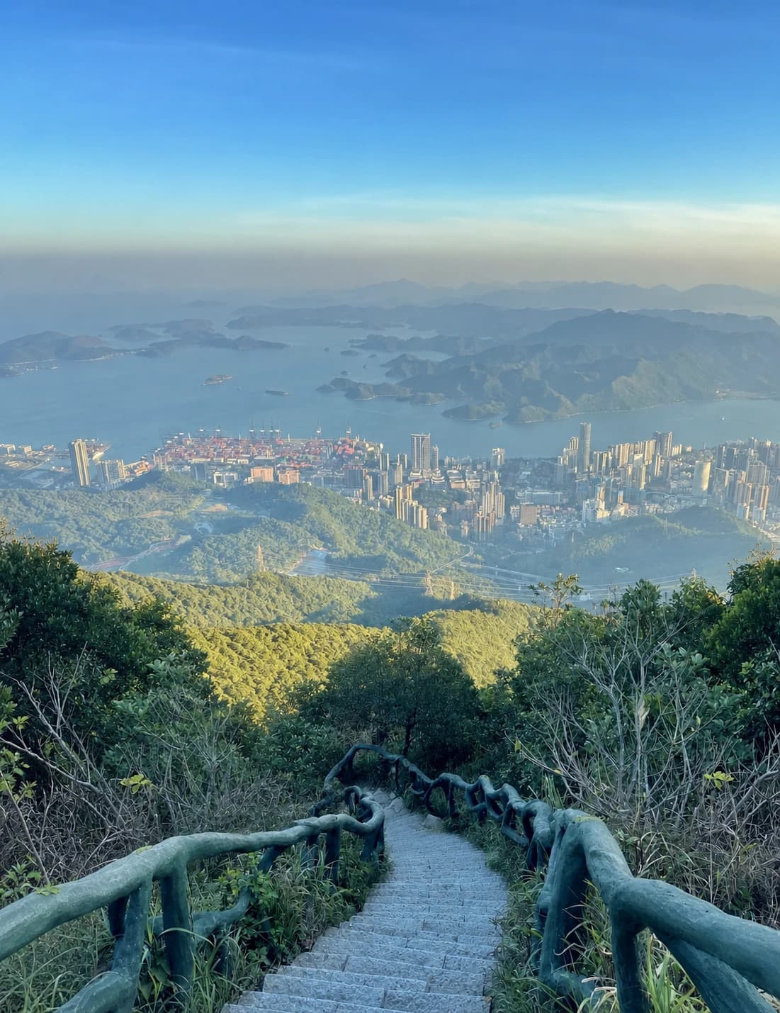
At 943.7 metres, Great Wutong (大梧桐) is Shenzhen's highest peak. The useful question is not simply whether to climb it, but which of the six managed routes matches your fitness, preferred scenery and exit plan. The entrances are spread across Luohu and Yantian, and Little Wutong and Great Wutong are separate objectives linked by additional ridge walking.
Decide the objective before the trail
- Choose Little Wutong (小梧桐) for a shorter mountain day, the television-tower area and access to Azalea Valley. Dengyun and Lingyun are the most direct approaches from the south-west side.
- Choose Great Wutong for the main summit stone and the broadest mountain-and-coast outlook. North Road, Taishan Stream, Xiutong and Bitong can all form part of a Great Wutong day, but they differ sharply in surface and effort.
- Allow most of a day if you want both summits or use one entrance to ascend and another to descend. First-time hikers often underestimate the extra ridge distance after reaching Little Wutong.
If you arrive by car, an out-and-back route avoids a long transfer after the hike. With public transport, a cross-mountain route is possible, but record the exit area and last-mile transport before starting.
Six official route choices
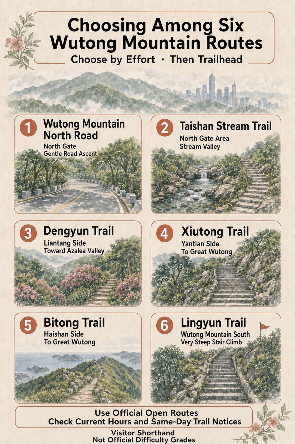
Wutong Mountain North Road: the gentle road option
Start from North Gate for a wide paved ascent with the least technical footing. The gradient is friendlier than the stair-heavy trails, although the route is long and exposed stretches can feel hot. It suits hikers who value a predictable surface more than a short climb.
Taishan Stream Trail: a shaded valley route
This trail starts in the North Gate area and follows a stream valley. It is a proper hiking path rather than the paved-road option, so wet stone, seasonal water levels and same-day maintenance matter. Do not choose it only for promised waterfalls: flow changes with recent weather.
Dengyun Trail: Liantang to Azalea Valley
Dengyun approaches from the Liantang side and reaches the Little Wutong and Azalea Valley sector. It is a useful choice when Little Wutong is the main goal or when you want a south-west exit. Flower conditions are seasonal, and the trail remains worthwhile as a forest climb outside the bloom period.
Xiutong Trail: a direct Yantian-side climb
Xiutong approaches from the Yantian side near the Shenzhen Foreign Languages School senior campus and leads toward Great Wutong. It compresses the ascent into a more direct, stair-heavy line. Choose it for efficiency only if sustained climbing and a steep descent suit your knees.
Bitong Trail: Haishan side to Great Wutong
Bitong begins on the Haishan side and leads to Great Wutong. Visitor reports value its open mountain-and-sea perspectives, but visibility depends on humidity and cloud. It makes more sense as a deliberate east-side mountain day than as an improvised extension after another long climb.
Lingyun Trail: the very steep stair climb
Lingyun starts from the Wutong Mountain South side and rises toward Little Wutong on prolonged, very steep steps. It is a compact but strenuous choice. Avoid it in rain, in poor visibility or when anyone in the group has weak knees, vertigo or little stair-hiking experience.
A sensible first visit
For a first hike, choose one summit and one ascent style. North Road is the most straightforward surface; Dengyun gives a forest approach to Little Wutong; Xiutong gives a direct climb toward Great Wutong; Taishan Stream prioritises trail scenery. Lingyun is a challenge route, not a shortcut for an unprepared visitor.
At every junction, follow the current park signs rather than a saved social-media map. If the group is already tired at Little Wutong, do not add Great Wutong simply because it appears close on a schematic. Turn around or use the signed descent that matches the transport plan.

Getting to the correct entrance
Metro Lines 2 and 8 serve the southern and eastern sides of the mountain. Wutong Mountain South is the approach for Lingyun, Liantang for Dengyun, Haishan for Bitong and Shenwai Senior Campus for Xiutong. North Gate normally requires a bus, taxi or longer last-mile connection.
Station exits, buses and scenic shuttles can change. Search the chosen trail name, not just “Wutong Mountain,” in your map app, then compare the pin with the park's current notice. A taxi to the wrong gate can leave you several kilometres from the intended route.
Current access and safety
Official Shenzhen sources checked in September 2026 list the scenic area's normal public hours as 06:00–19:00 and say night hiking is not currently open. Weather, fire-control measures, trail repairs and crowd management can override normal access. Check the official Wutong Mountain Scenic Area WeChat account on the morning of the hike.
Carry enough water and food for the chosen route; do not assume every kiosk or shuttle will be operating. Wear shoes with grip, bring sun and rain protection, and keep a charged phone. After rain, avoid steep stone steps and stream sections. Stay on formal scenic-area trails: unofficial shortcuts create both rescue risk and erosion.
Clear, dry mornings usually give the best chance of views and lower heat. In summer, start early and treat shade and hydration as route criteria. In cooler months, carry a layer for exposed ridges. If cloud closes in, turn the day into a forest hike instead of chasing a summit view.